

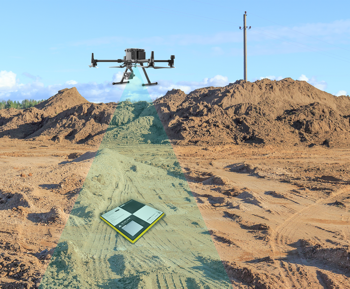
Mapping has always been at the heart of human progress. From ancient hand-drawn charts to satellite imagery, each leap in technology has transformed how we understand and interact with the world. Today, one of the most significant advancements in this field is the rise of drone surveying. Powered by unmanned aerial vehicles (UAVs), drone surveying is reshaping industries by making mapping faster, more accurate, and more accessible than ever before.
The Evolution of Mapping Technologies
Traditional surveying methods relied heavily on manual labour, physical tools, and significant time investment. Surveyors would measure land using chains, theodolites, and total stations, often working for days or weeks to gather data. While effective, these methods were slow, expensive, and sometimes limited by terrain.
The introduction of aerial photography and satellite imaging—such as those used by organizations like NASA—marked a major shift. These technologies allowed for broader perspectives, but they still had limitations in resolution, cost, and accessibility.
Now, drone surveying represents the next leap forward. Combining advanced imaging, GPS technology, and sophisticated software, drones can capture highly detailed data from the air in a fraction of the time required by traditional methods.
What Is Drone Surveying?
Drone surveying involves the use of UAVs equipped with cameras, LiDAR sensors, or other imaging tools to capture aerial data. This data is then processed using specialized software to create maps, 3D models, and spatial analyses.
Companies like DJI have played a significant role in popularizing drone technology, making it more accessible to professionals across industries. With drones, surveyors can quickly gather high-resolution images and generate detailed maps with remarkable precision.
Key Advantages of Drone Surveying
1. Speed and Efficiency
One of the most notable benefits of drone surveying is speed. Tasks that once took days or weeks can now be completed in hours. A single drone flight can cover large areas, collecting thousands of data points in a short time.
This efficiency is especially valuable in industries such as construction and agriculture, where timely data can directly impact project success and productivity.
2. High Accuracy and Resolution
Modern drones are equipped with advanced sensors and GPS systems that enable centimeter-level accuracy. By capturing overlapping images and using photogrammetry techniques, drones can produce highly detailed 3D models and topographic maps.
This level of precision is crucial for engineering projects, infrastructure planning, and environmental monitoring.
3. Cost-Effectiveness
Compared to traditional surveying methods, drone surveying can significantly reduce costs. Fewer personnel are required, and the time spent on-site is minimized. Additionally, drones can access hard-to-reach or hazardous areas without the need for expensive equipment or extensive safety measures.
Applications Across Industries
Drone surveying is not limited to one field—it is revolutionizing a wide range of industries.
Construction and Infrastructure
In construction, drones are used for site analysis, progress tracking, and inspection. They provide real-time data that helps project managers make informed decisions and detect issues early.
Infrastructure companies also use drones to inspect bridges, roads, and buildings, reducing the need for manual inspections that can be dangerous and time-consuming.
Agriculture
In agriculture, drone surveying supports precision farming. Farmers use drones to monitor crop health, assess irrigation, and detect pest infestations. This allows for more efficient use of resources and improved crop yields.
Environmental Monitoring
Organizations like United Nations Environment Programme (UNEP) use advanced technologies, including drones, to monitor environmental changes. Drones help track deforestation, coastal erosion, and wildlife populations, providing critical data for conservation efforts.
Mining and Resource Management
In the mining industry, drones are used to survey large and often dangerous areas. They can measure stockpiles, map terrain, and monitor operations, improving both safety and efficiency.
Disaster Response
Drones are invaluable in disaster management. After natural disasters such as floods, earthquakes, or landslides, drones can quickly assess damage and identify affected areas. This information helps emergency responders coordinate rescue and recovery efforts more effectively.
The Role of Advanced Technologies
Drone surveying is not just about hardware—it relies heavily on software and data processing technologies.
Photogrammetry
Photogrammetry is the process of creating maps and 3D models from photographs. By stitching together overlapping images, software can reconstruct accurate representations of terrain and structures.
LiDAR Technology
Light Detection and Ranging (LiDAR) is another powerful tool used in drone surveying. It uses laser pulses to measure distances and create highly detailed elevation models. LiDAR is especially useful in areas with dense vegetation, where traditional imaging may not be effective.
2. High Accuracy and Resolution
0
Artificial intelligence (AI) is increasingly being integrated into drone surveying workflows. AI-powered software can analyze images, detect patterns, and automate data processing. This reduces the time required for analysis and enhances accuracy.
Challenges and Limitations
Despite its many advantages, drone drone survey is not without challenges.
2. High Accuracy and Resolution
1
In many countries, drone usage is regulated by aviation authorities. Operators must obtain licenses, follow flight restrictions, and comply with safety regulations. These rules can limit where and how drones are used.
2. High Accuracy and Resolution
2
Drones are sensitive to weather conditions such as strong winds, rain, and extreme temperatures. Adverse weather can affect flight stability and data quality.
2. High Accuracy and Resolution
3
Drone surveys generate large volumes of data. Managing, processing, and storing this data can be complex and requires powerful computing systems.
2. High Accuracy and Resolution
4
While drone surveying can save money in the long run, the initial investment in high-quality drones, sensors, and software can be significant.
The Future of Drone Surveying
The future of drone surveying looks promising, with continued advancements in technology set to expand its capabilities.
2. High Accuracy and Resolution
5
With the expansion of 5G networks, drones will be able to transmit data in real time, enabling faster decision-making and remote operations.
2. High Accuracy and Resolution
6
Autonomous drones capable of planning and executing surveys without human intervention are becoming more common. This will further improve efficiency and reduce operational costs.
2. High Accuracy and Resolution
7
As AI technology evolves, drones will become smarter, capable of identifying objects, analyzing terrain, and making decisions on the fly.
2. High Accuracy and Resolution
8
As technology becomes more affordable, drone surveying will become accessible to smaller businesses and even individuals, democratizing access to high-quality mapping tools.
Conclusion
Drone surveying is revolutionising the field of mapping by combining speed, accuracy, and accessibility in ways that were previously unimaginable. From construction and agriculture to environmental monitoring and disaster response, its applications are vast and impactful.
With continued advancements in technology and increasing adoption across industries, drone surveying is poised to become the standard for modern mapping. It represents not just an improvement in tools, but a transformation in how we collect, analyse, and use spatial data to shape the future.
2. High Accuracy and Resolution
9

Leave a Reply